RideWithGPS Introduces Surface Types

Press Release:
Want to know if there’s going to be a gravel section in the middle of your road ride? Or perhaps not be disappointed by all the tarmac on your backcountry bikepacking adventure? Good news! Let us officially introduce our new Surface Types feature, allowing you to see the road’s surface type as you plan, view, and navigate routes so that you can prepare for the road —or trail— ahead.Surface Types is the latest tool in the vast and exclusive Ride with GPS planning tool kit that already includes a heatmap overlay, satellite maps, and street view — leaving little room for questions as you head out on your adventure prepared.
Before you go:
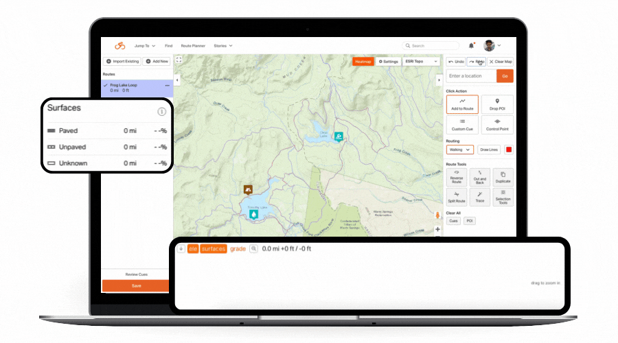
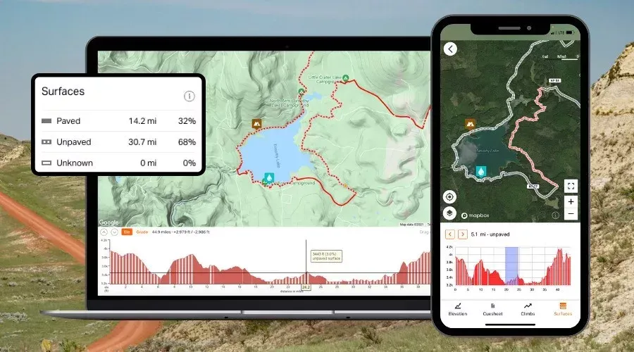
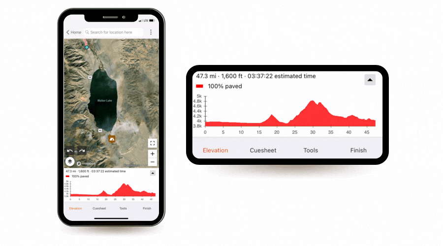
Web and mobile users will now be able to distinguish paved roads from the unpaved roads or trails while planning or viewing routes. This takes the guesswork out of route planning and ensures that you’re leaving the house prepared for what’s ahead and on the appropriate set of tires.There are three surface type categories:
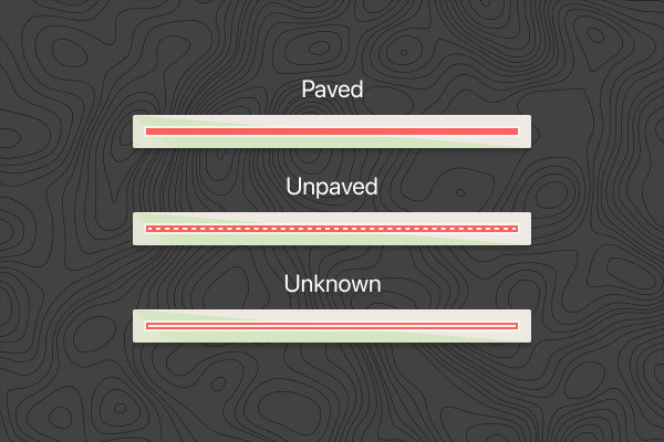
- Paved – Paved surfaces include asphalt, concrete, and chip seal. Paved surfaces are shown as a solid line.
- Unpaved – Unpaved surfaces include gravel, dirt, cobblestones and natural/unimproved trails. Unpaved surfaces are shown as a dashed line.
- Unknown – When there is insufficient data available about a surface it will show up as unknown. Unknown surfaces are shown as an outlined white line.
“I’ve been tasked with designing several event routes remotely, sometimes in rather distant locations with very little time for recon, so having a solid, realistic expectation of conditions is critical. The ability to dial in an accurate read on route conditions from afar is a huge advantage,” said Ron Lewis, of the premier adventure planning group, OMTM.cc.“Alongside heatmaps and detailed satellite view, this is another solid tool that is instrumental for conceptualizing routes and setting expectations before you get a chance to test things out.”
And on the go:
Viewing and navigating routes from your app? Route overview, route lines and elevation profiles will now visually reflect the surface types of your route as outlined above. Likewise, surface types will appear as you plan your route using the mobile route planner as well. This way, there will be fewer surprises as you route a detour on the go!“Our mission is to help users go on better rides, more often. Knowing the surface type doesn’t just help route planners, it provides a better riding experience for everyone, and encourages folks to discover more places to ride,” said Zack Ham, Ride with GPS founder.
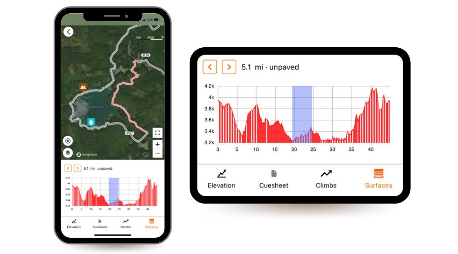
“Especially with gravel riding being so popular, Surface Types helps users find the ride that they’re looking for — one with little pavement. The Surface Types feature is available on our web and app platform, and breaks down the terrain by percentage so you know exactly what you’re in for.”
Because you know your local roads best…
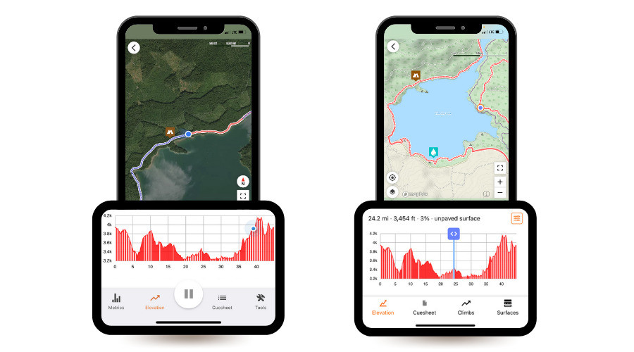
Like many other services out there, Ride with GPS relies on surface type data from OpenStreetMap (OSM), an open-source mapping service of the entire world. But we recognize that this data is incomplete, and our users riding those roads day in, day out know best. Therefore, we’re the first route planning service to allow users to visually adjust the surface types of their personal routes using the Ride with GPS Route Planner. For permanent changes, we encourage users to contribute up-to-date surface types information to OSM as well. Learn how.