Zwift Worlds and Routes
Currently, there are 9 worlds on Zwift, each with its own routes. While Watopia is always available, Zwift also features two rotating guest worlds that changes on a monthly schedule. You can log into the game to see the current world schedule (in the lower-right of the Drop In screen), or check out the Community Page to see what’s coming up. World changeovers occur at approximately 9:00 PM (PT).
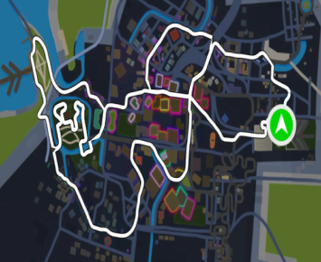
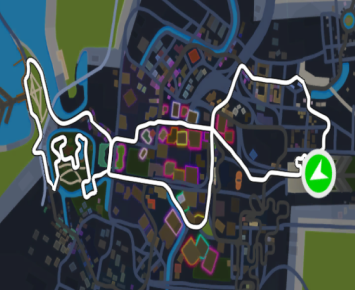
Makuri Islands
| Route | Details |
|---|---|
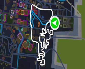 |
Route Name: Railways and Rooftops Lead-In Distance: 1.7 km (1.0 mi) Route Distance: 7.8 km (4.9 mi) Total Distance:9.5 km (5.9 mi) Lead-In Elevation Gain: 20 m (66 ft) Route Elevation Gain: 90 m (297 ft) Total Elevation Gain: 110 m (363 ft) Notes: Take to the upper city where you will race along city railways and rooftops. |
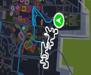 |
Route Name: Rooftop Rendezvous Lead-In Distance: 2.4 km (1.5 mi) Route Distance: 6.2 km (3.8 mi) Total Distance: 8.6 km (5.3 mi) Lead-In Elevation Gain: 24 m (81 ft) Route Elevation Gain: 81 m (265 ft) Total Elevation Gain: 105 m (346 ft) Notes: Feel the burn climbing to the tip top of Neokyo as you scale rooftops and monorails. |
 |
Route Name: Neon Flats Lead-In Distance: 0.0 km (0.0 mi) Route Distance:14.7 km (9.1 mi) Total Distance: 14.7 km (9.1 mi) Lead-In Elevation Gain: 0 m (0 ft) Route Elevation Gain: 72 m (236 ft) Total Elevation Gain: 72 m (236 ft) Notes: Paint the town as you dominate three sprints along this flat route through the city. |
 |
Route Name: Sprinter’s Playground Lead-In Distance: 0.0 km (0.0 mi) Route Distance:12.3 km (7.7 mi) Total Distance: 12.3 km (7.7 mi) Lead-In Elevation Gain: 0 m (0 ft) Route Elevation Gain: 67 m (221 ft) Total Elevation Gain: 67 m (221 ft) Notes: Keep that heart racing as you complete four sprints in a single route. |
 |
Route Name: Neokyo All-Nighter Lead-In Distance: 0.1 km (0.0 mi) Route Distance:24.3 km (15.1 mi) Total Distance: 24.4 km (15.1 mi) Lead-In Elevation Gain: 0 m (0 ft) Route Elevation Gain: 167 m (549 ft) Total Elevation Gain: 167 m (549 ft) Notes: Explore everything that Neokyo has to offer including four sprints and a KOM along this challenging route. |
 |
Route Name: Sleepless City Lead-In Distance: 0.0 km (0.0 mi) Route Distance:9.6 km (5.9 mi) Total Distance: 9.6 km (5.9 mi) Lead-In Elevation Gain: 0 m (0 ft) Route Elevation Gain: 42 m (139 ft) Total Elevation Gain: 42 m (13 ft) Notes: Make your way through the heart of the city as you wind along this flat route. |
 |
Route Name: Wandering Flats Lead-In Distance: 0.0 km (0.0 mi) Route Distance:25.1 km (15.6 mi) Total Distance: 25.1 km (15.6 mi) Lead-In Elevation Gain: 0 m (0 ft) Route Elevation Gain: 145 m (477 ft) Total Elevation Gain: 145 m (447 ft) Notes: This long flatter route will take you from the scenic countryside to the bustling city. |
 |
Route Name: Temples and Towers Lead-In Distance: 0.4 km (0.2 mi) Route Distance:32.9 km (20.5 mi) Total Distance: 33.3 km (20.7 mi) Lead-In Elevation Gain: 0 m (2 ft) Route Elevation Gain: 319 m (1046 ft) Total Elevation Gain: 319 m (1048 ft) Notes: From downtown rooftops to mystical temples, grind to complete three KOM’s in a single route. |
 |
Route Name: Chain Chomper Lead-In Distance: 0.0 km (0.0 mi) Route Distance: 13.6 km (8.5 mi) Total Distance: 13.6 km (8.5 mi) Lead-In Elevation Gain: 0 m (0 ft) Route Elevation Gain: 184 m (604 ft) Total Elevation Gain: 184 m (604 ft) Notes: Two challenging KOM’s and a Sprint! Test your endurance with this looped route around the countryside. |
 |
Route Name: Countryside Tour Lead-In Distance: 0.1 km (0.0 mi) Route Distance: 15.8 km (9.9 mi) Total Distance: 15.9 (9.9 mi) Lead-In Elevation Gain: 0 m (0 ft) Route Elevation Gain:185 m (607 ft) Total Elevation Gain: 185 m (607 ft) Notes: From farmlands to mystical mountains, this looped route is the perfect way to visit the countryside! |
 |
Route Name: Farmland Loop Lead-In Distance: 0.0 km (0.0 mi) Route Distance: 7.8 km (4.8 mi) Total Distance: 7.8 km (4.8 mi) Lead-In Elevation Gain: 0 m (0 ft) Route Elevation Gain: 57 m (187 ft) Total Elevation Gain: 57 m (187 ft) Notes: Take in the sun riding this wide-open farmland route through the countryside |
 |
Route Name: Flatland Loop Lead-In Distance: 0.0 km (0.0 mi) Route Distance: 12.9 km (8 mi) Total Distance: 12.9 km (8.0 mi) Lead-In Elevation Gain: 0 m (0 ft) Route Elevation Gain:99 m (325 ft) Total Elevation Gain: 99 m (325 ft) Notes: A gentle and flat route winding around the countryside. |
 |
Route Name: Kappa Quest Lead-In Distance: 3.3 km (2.1 mi) Route Distance: 9.1 km (5.6 mi) Total Distance: 12.4 km (7.7 mi) Lead-In Elevation Gain: 107 m (354 ft) Route Elevation Gain: 140 m (459 ft) Total Elevation Gain: 247 m (813 ft) Notes: This scenic loop is filled with Temples and Shrines. Keep watch and you might see a Kappa or two! |
 |
Route Name: Kappa Quest Reverse Lead-In Distance: 5.0 km (3.1 mi) Route Distance: 9.1 km (5.7 mi) Total Distance: 14.1 km (8.8 mi) Lead-In Elevation Gain: 130 m (427 ft) Route Elevation Gain: 141 m (462 ft) Total Elevation Gain: 271 m (889 ft) Notes: This scenic reverse loop is filled with Temples and Shrines. Work your way through winding rivers and bamboo forests. |
 |
Route Name: Sea to Tree Lead-In Distance: 0.0 km (0.0 mi) Route Distance: 3.3 km (2 mi) Total Distance: 3.3 km (2.0 mi) Lead-In Elevation Gain: 0 m (0 ft) Route Elevation Gain: 107 m (352 ft) Total Elevation Gain: 107 m (352 ft) Notes: A short, challenging climb from the peaceful Fishing Village to the Mystical Tree hidden in the Mountains. |
 |
Route Name: Spirit Forest Lead-In Distance: 4.1 km (2.5 mi) Route Distance: 8.4 km (5.3 mi) Total Distance: 12.5 km (7.8 mi) Lead-In Elevation Gain: 107 m (352 ft) Route Elevation Gain: 135 m (442 ft) Total Elevation Gain: 242 m (794 ft) Notes: Grind your way through this mystical figure 8. Visit at night and ride with the spirits! |
 |
Route Name: Suki’s Playground Lead-In Distance: 0.1 km (0.0 mi) Route Distance: 18.3 km (11.4 mi) Total Distance: 18.4 km (11.4 mi) Lead-In Elevation Gain: 0 m (0 ft) Route Elevation Gain: 149 m (491 ft) Total Elevation Gain: 149 m (491 ft) Notes: Chase your fitness goals on this winding gentle figure 8 through the idyllic countryside. |
 |
Route Name: Three Village Loop Lead-In Distance: 0.0 km (0.0 mi) Route Distance: 10.6 km (6.6 mi) Total Distance: 10.6 km (6.6 mi) Lead-In Elevation Gain: 0 m (0 ft) Route Elevation Gain: 92 m (303 ft) Total Elevation Gain: 92 m (303 ft) Notes: Climb, sprint, and explore three unique villages in one big loop. |
 |
Route Name: Two Village Loop Lead-In Distance: 0.1 km (0.0 mi) Route Distance: 12.8 km (8.0 mi) Total Distance: 12.9 km (8.0 mi) Lead-In Elevation Gain: 0 m (0 ft) Route Elevation Gain: 88 m (289 ft) Total Elevation Gain: 88 m (289 ft) Notes: Explore two villages as you pedal through this challenging circuit. |
 |
Route Name: Valley to Mountaintop Lead-In Distance: 0.0 km (0.0 mi) Route Distance: 5.0 km (3.1 mi) Total Distance: 5.0 km (3.1 mi) Lead-In Elevation Gain: 0 m (0 ft) Route Elevation Gain: 130 m (428 ft) Total Elevation Gain: 130 m (428 ft) Notes: A short climb through the golden forest to the Mystical Tree Temple. |
France
| Route | Details |
|---|---|
 |
Route Name: Casse-Pattes Lead-In Distance: 0.9 km (0.6 mi) Route Distance: 22.9 km (14.2 mi) Total Distance: 23.8 km (14.8 mi) Lead-In Elevation Gain: 0 m (0 ft) Route Elevation Gain: 155 m (508 ft) Total Elevation Gain: 155 m (508 ft) Notes: Roll through the flatlands before ascending the switch backs up to the hilly KOM. After a fast and furious descent, hit the Marina for a mad-dash finish. |
 |
Route Name: Douce France Lead-In Distance: 0.08 km (0.5 mi) Route Distance: 24.72 km (14.9 mi) Total Distance:24.8 km (15.4 mi) Lead-In Elevation Gain: 3 m (10 ft) Route Elevation Gain: 133 m (438 ft) Total Elevation Gain: 136 m (448 ft) Notes: Roll past stunning chalets, seasides, and sunflowers. The sights and sounds of France are all around you. It’s a sweet route, but there’s some sting in it too. |
 |
Route Name: Petit Boucle Lead-In Distance: 1.0 km (0.6 mi) Route Distance: 60.8 km (37.8 mi) Total Distance: 61.8 km (38.4 mi) Lead-In Elevation Gain: 0 m (0 ft) Route Elevation Gain: 483 m (1585 ft) Total Elevation Gain: 483 m (1585 ft) Notes: This little loop takes in all the roads of the valley in both directions. |
 |
Route Name: R.G.V. Lead-In Distance: 1.0 km (0.6 mi) Route Distance: 24 km (0 mi) Total Distance: 25 km (15.5 mi) Lead-In Elevation Gain: 0 m (0 ft) Route Elevation Gain: 133 m (437 ft) Total Elevation Gain: 133 m (437 ft) Notes: A high-speed spritner’s course that traverses the flatter roads of the French countryside. |
 |
Route Name: Roule Ma Poule Lead-In Distance: 4.3 km (2.7 mi) Route Distance: 22.9 km (14.2 mi) Total Distance: 27.2 km (16.9 mi) Lead-In Elevation Gain: 107 m (353 ft) Route Elevation Gain: 155 m (499 ft) Total Elevation Gain: 262 m (852 ft) Notes: Get ready to roll on this undulating course. Take the direct route up to the hilly KOM, descend the switchbacks, and then traverse the flatter countryside. |
 |
Route Name: Tire-Bouchon Lead-In Distance: 3.1 km (1.9 mi) Route Distance: 60.8 km (37.8 mi) Total Distance: 63.9 km (39.7 mi) Lead-In Elevation Gain: 107 m (353 ft) Route Elevation Gain: 483 m (1584 ft) Total Elevation Gain: 590 m (1937 ft) Notes: This route heads straight up to the hilly KOM before corkscrewing its way around the valley. After a lap of this, you might need a glass of wine…or two. |
 |
Route Name: Ven-Top Lead-In Distance: 0.2 km (0.1 mi) Route Distance: 20.7 km (12.9 mi) Total Distance: 20.9 km (13.0 mi) Lead-In Elevation Gain: 0 m (0 ft) Route Elevation Gain: 1539 m (5050 ft) Total Elevation Gain: 1539 m (5050 ft) Notes: The shortest route to the legendary summit. |
Paris
| Route Name | Details |
|---|---|
 |
Route Name: Champs-Elysee Lead-In Distance: 3.2 km (2.0 mi) Route Distance: 6.6 km (4.1 mi) Total Distance: 9.8 km (6.1 mi) Lead-In Elevation Gain: 13 m (43 ft) Route Elevation Gain: 39 m (130 ft) Total Elevation Gain: 52 m (173 ft) Notes: The most famous finishing sprint in cycling. |
 |
Route Name: Lutece Express Lead-In Distance: 3.7 km (2.3 mi) Route Distance: 6.6 km (4.1 mi) Total Distance: 10.3 km (6.4 mi) Lead-In Elevation Gain: 26 m (85 ft) Route Elevation Gain: 39 m (130 ft) Total Elevation Gain: 65 m (215 ft) Notes: Rewind history as you travel the roads of Paris. |
Watopia
| Route | Detail |
|---|---|
 |
Route Name: Climber’s Gambit Lead-In Distance: 0.1 km (0.0 mi) Route Distance: 27.8 km (17.3 mi) Total Route Distance: 27.9 km (17.3 mi) Lead-In Elevation Gain: 0 m (0 ft) Route Elevation Gain: 670 m (2199 ft) Total Elevation Gain: 670 m (2199 ft) Notes: Do your best to gain the advantage on this risky route that leads you from the warm Watopia Pier to the frigid high mountains. |
 |
Route Name: Legends and Lava Lead-In Distance: 0.2 km (0.1 mi) Route Distance: 24.5 km (15.2 mi) Total Route Distance: 24.7 km (15.3 mi) Lead-In Elevation Gain: 0 m (0 ft) Route Elevation Gain: 352 m (1155 ft) Total Elevation Gain: 352 m (1155 ft) Notes: Become a true legend riding out of the frying pan and into the fire as you make your way from Fuego Flats into the searing Volcano. |
 |
Route Name: Hilly Route Lead-In Distance: 0.5 km (0.4 mi) Route Distance: 8.9 km (5.4 mi) Total Route Distance: 9.4 km (5.8 mi) Lead-In Elevation Gain: 0 m (2 ft) Route Elevation Gain: 109 m (356 ft) Total Elevation Gain: 110 m (358 ft) Notes: Watopia’s Hilly Route includes the KOM and sprint sections. Can be ridden in reverse. |
 |
Route Name: Flat Route Lead-In Distance: 0.6 km (0.4 mi) Route Distance:9.9 km (6.1 mi) Total Distance: 10.5 km (6.5 mi) Lead-In Elevation Gain: 0 m (1 ft) Route Elevation Gain: 61 m (201 ft) Total Elevation Gain: 61 m (202 ft) Notes: Ridethe flattest roads on Watopia. Can be ridden in reverse. |
 |
Route Name: Figure 8 Lead-In Distance: 1.2 km (0.8 mi) Route Distance: 29.7 km (18.4 mi) Total Distance: 30.9 km (19.2 mi) Lead-In Elevation Gain: 1 m (3 ft) Route Elevation Gain: 254 m (834 ft) Total Elevation Gain: 255 m (837 ft) Notes: Combine the Hilly Roads and Flat Roads courses for a long, double loop of the island. |
 |
Route Name: Figure 8 Reverse Lead-In Distance: 0.2 km (0.1 mi) Route Distance: 29.7 km (18.5 mi) Total Distance: 29.9 km (18.6 mi) Lead-In Elevation Gain: 0 m (0 ft) Route Elevation Gain: 254 m (833 ft) Total Elevation Gain: 254 m (833 ft) Notes: Combine the Hilly Roads and Flat Roads courses for a long double loop of the island. |
 |
Route Name: Mountain Route Lead-In Distance: 0.6 km (0.4 mi) Route Distance: 29.3 km (18.2 mi) Total Distance: 29.9 m (18.6 mi) Lead-In Elevation Gain: 0 m (2 ft) Route Elevation Gain: 683 m (2239 ft) Total Elevation Gain: 683 m (2241 ft) Notes: Climb the highest peak in Watopia all the way to the Radio Tower. Save your Aero Boost for the fast descent! Can be |
 |
Route Name: Mountain 8 Lead-In Distance: 0.6 km (0.4 mi) Route Distance: 31.9 km (19.8 mi) Total Distance: 32.5 km (20.2 mi) Lead-In Elevation Gain: 0 m (3 ft) Route Elevation Gain: 692 m (2268 ft) Total Elevation Gain: 692 m (2271 ft) Notes: Combine the Mountain and Radio Tower climbs before looping out to the flats for recovery. Can be ridden in reverse. |
 |
Route Name: The Pretzel Lead-In Distance: 0.6 km (0.4 mi) Route Distance: 72.2 km (44.8 mi) Total Distance: 72.8 km (45.2 mi) Lead-In Elevation Gain: 0 m (3 ft) Route Elevation Gain: 1361 m (4463 ft) Total Elevation Gain: 1361 m (4466 ft) Notes: A long ride starting with the KOM, then rounding the Epic KOM with a detour up to the Radio Tower and a fast descent back. |
 |
Route Name: The Mega Pretzel Lead-In Distance: 0.0 km (0.0 mi) Route Distance:107.3 km (66.7 mi) Total Distance: 107.3 km (66.7 mi) Lead-In Elevation Gain: 0 m (0 ft) Route Elevation Gain: 1638 m (5375 ft) Total Elevation Gain: 1638 m (5375 ft) Notes: You thought the Pretzel was a challenge? Try the KOM, Epic KOM, Mayan Ruins, followed by the Volcano Climb. Enjoy! Level Unlock Required: Level 10 |
 |
Route Name: Volcano Flat Lead-In Distance: 0.6 km (0.4 mi) Route Distance: 12.6 km (7.8 mi) Total Distance: 13.2 km (8.2 mi) Lead-In Elevation Gain: 1 m (3 ft) Route Elevation Gain: 50 m (166 ft) Total Elevation Gain: 51 m (169 ft) Notes: The Volcano Flat loop includes most of the Flat Roads minus ‘The Esses’. |
 |
Route Name: Volcano Circuit Lead-In Distance: 1.3 km (0.8 mi) Route Distance: 4.1 km (2.6 mi) Total Distance (per lap): 5.4 km (3.4 mi) Lead-In Elevation Gain: 7 m (24 ft) Route Elevation Gain: 20 m (67 ft) Total Elevation Gain (per lap): 27 m (91 ft) Notes: Ride around, and through, the magma filled inferno created just off the coast of Watopia. |
 |
Route Name: Volcano Circuit CCW Lead-In Distance: 3.4 km (2.1 mi) Route Distance: 4.1 km (2.6 mi) Total Distance (per lap): 7.5 km (4.7 mi) Lead-In Elevation Gain: 17 m (57 ft) Route Elevation Gain: 20 m (67 ft) Total Elevation Gain (per lap): 37 m (124 ft) Notes: Same as the Volcano Circuit but reverse direction. |
 |
Route Name: Volcano Climb Lead-In Distance: 0.6 km (0.4 mi) Route Distance: 22.5.8 km (13.9 mi) Total Distance: 23.1 km (14.3 mi) Lead-In Elevation Gain: 0 m (2 ft) Route Elevation Gain: 203 m (666 ft) Total Elevation Gain: 203 m (668 ft) Notes: Circumnavigate the shoreline of Watopia and finish with a climb over the Volcano. |
 |
Route Name: Three Sisters Lead-In Distance: 0.6 km (0.4 mi) Route Distance: 47.6 km (29.6 mi) Total Distance: 48.2 km (30.0 mi) Lead-In Elevation Gain: 0 m (2 ft) Route Elevation Gain: 896 m (2938 ft) Total Elevation Gain: 896 m (2940 ft) Notes: Start your climb over the KOM, turn up to the Radio Tower, and after a fast descent, finish your final climb over the top of the Volcano. Can be ridden in reverse. |
 |
Route Name: Big Loop Lead-In Distance: 1.4 km (0.9 mi) Route Distance: 43.6 km (27.1 mi) Total Distance: 45.0 km (28.0 mi) Lead-In Elevation Gain: 3 m (11 ft) Route Elevation Gain: 665 m (2182 ft) Total Elevation Gain: 668 m (2193 ft) Notes: Explore the regions of Watopia: |
 |
Route Name: Road to Ruins Lead-In Distance: 0.7 km (0.4 mi) Route Distance: 29.2 km (18.2 mi) Total Distance: 29.9 km (18.6 mi) Lead-In Elevation Gain: 1 m (3 ft) Route Elevation Gain: 274 m (902 ft) Total Elevation Gain: 275 m (905 ft) Notes: Ride the gentle climb up to the Jungle, cross the rope bridge and finish on the Volcano Flat. Level Unlock Required: Level 10 |
 |
Route Name: Jungle Circuit Lead-In Distance:6.0 km (3.7 mi) Route Distance: 7.9 km (4.9 mi) Total Distance (per lap): 13.9 km (8.6 mi) Lead-In Elevation Gain: 16 m (52 ft) Route Elevation Gain: 82 m (272 ft) Total Elevation Gain(per lap): 98 m (324 ft) Notes: A flat warmup leads to the start of the Jungle Circuit, then do laps until your legs fall off. Level Unlock Required: Level 10 |
 |
Route Name: Road to Sky Lead-In Distance: 0.4 km (0.2 mi) Route Distance: 17.5 km (10.9 mi) Total Distance: 17.9 km (11.1 mi) Lead-In Elevation Gain:6 m (22 ft) Route Elevation Gain: 1046 m (3431 ft) Total Elevation Gain: 1052 m (3453 ft) Notes: The shortest route to the longest climb. Level Unlock Required: Level 12 |
 |
Route Name: Tour of Fire and Ice Lead-In Distance: 0.1 km (0.1 mi) Route Distance: 25.4 km (15.7 mi) Total Distance: 25.5 km (15.8 mi) Lead-In Elevation Gain: 1 m (5 ft) Route Elevation Gain: 1165 m (3820 ft) Total Elevation Gain: 1166 m (3825 ft) Notes: Winter is coming, but only after you ride out of the fiery pits of the Volcano. Level Unlock Required: Level 12 |
 |
Route Name: Four Horsemen Lead-In Distance: 0.6 km (0.4 mi) Route Distance: 89.8 km (55.7 mi) Total Distance: 90.4 km (56.1 mi) Lead-In Elevation Gain: 2 m (8 ft) Route Elevation Gain: 2109 m (6918 ft) Total Elevation Gain: 2111 m (6926 ft) Notes: This is gonna hurt. Level Unlock Required: Level 12 |
 |
Route Name: Out and Back Again Lead-In Distance: 2.5 km (1.5 mi) Route Distance: 39.9 km (24.8 mi) Total Distance: 42.4 km (26.3 mi) Lead-In Elevation Gain:6 m (20 ft) Route Elevation Gain: 328 m (1076 ft) Total Elevation Gain: 334 m (1096 ft) Notes: A cyclist’s meandering journey takes you through the fiery depths of the Volcano and then up to its barren summit before bringing you back home again. |
 |
Route Name: Tempus Fugit Lead-In Distance: 2.5 km (1.5 mi) Route Distance: 17.2 km (10.7 mi) Total Distance: 19.7 km (12.2 mi) Lead-In Elevation Gain: 6 m (20 ft) Route Elevation Gain: 25 m (84 ft) Total Elevation Gain: 31 m (104 ft) Notes: Time flies and so will you on this flat and fast course through the desert. |
 |
Route Name: The Uber Pretzel Lead-In Distance: 0.5 km (0.3 mi) Route Distance: 128.3 km (79.7 mi) Total Distance: 128.8 km (80.0 mi) Lead-In Elevation Gain: 1 m (4 ft) Route Elevation Gain: 2380 m (7808 ft) Total Elevation Gain: 2381 m (7812 ft) Notes: If somehow this isn’t enough for you, there’s also the bonus climb up to the Radio Tower… Level Unlock Required: Level 12 |
 |
Route Name: Bigger Loop Lead-In Distance: 0.5 km (0.3 mi) Route Distance: 53.2 km (33.1 mi) Total Distance: 53.7 km (33.4 mi) Lead-In Elevation Gain: 1 m (3 ft) Route Elevation Gain: 691 m (2268 ft) Total Elevation Gain: 692 m (2271 ft) Notes: Bigger than the Big Loop, add in a trip through the desert as a part of a winding tour around the regions of Watopia. Level Unlock Required: Level 10 |
 |
Route Name: Tick Tock Lead-In Distance: 2.5 km (1.5 mi) Route Distance: 16.8 km (10.5 mi) Total Distance: 19.3 km (12.0 mi) Lead-In Elevation Gain: 6 m (20 ft) Route Elevation Gain: 53 m (175 ft) Total Elevation Gain: 59 m (195 ft) Notes: A clockwise loop through the driest sands of the desert and the submerged roads of the underwater tunnel. |
 |
Route Name: Whole Lotta Lava Lead-In Distance: 3.4 km (2.1 mi) Route Distance: 12.3 km (7.6 mi) Total Distance: 15.7 km (9.7 mi) Lead-In Elevation Gain: 17 m (57 ft) Route Elevation Gain: 160 m (526 ft) Total Elevation Gain: 177 m (583 ft) Notes: A fiery figure-8 that alternates laps of the Volcano Circuit with trips up and down the Volcano KOM. |
 |
Route Name: Muir And The Mountain Lead-In Distance: 4.7 km (2.9 mi) Route Distance: 34.2 km (21.3 mi) Total Distance: 38.9 km (24.2 mi) Lead-In Elevation Gain: 121 m (399 ft) Route Elevation Gain: 793 m (2600 ft) Total Elevation Gain:914 m (2999 ft) Notes: The Mountains are calling, and you must go. |
 |
Route Name: Sand and Sequoias Lead-In Distance: 2.5 km (1.5 mi) Route Distance: 20.1 km (12.6 mi) Total Distance:22.6 km (14.1 mi) Lead-In Elevation Gain: 6 m (20 ft) Route Elevation Gain: 175 m (574 ft) Total Elevation Gain:181 m (594 ft) Notes: From the scorched desert to the sylvan wilderness, this loop takes in every facet of Watopia’s wild west. |
 |
Route Name: Big Foot Hills Lead-In Distance: 2.5 km (1.5 mi) Route Distance: 67.6 km (42 mi) Total Distance:70.1 km (43.5 mi) Lead-In Elevation Gain: 6 m (20 ft) Route Elevation Gain: 708 m (2323 ft) Total Elevation Gain:714 m (2343 ft) Notes: An undulating journey that rolls up and over the lower peaks of Watopia. |
 |
Route Name: Dust in the Wind Lead-In Distance: 0.3 km (0.2 mi) Route Distance: 52.1 km (32.4 mi) Total Distance: 52.4 km (32.6 mi) Lead-In Elevation Gain: 0 m (0 ft) Route Elevation Gain: 582 m (1911 ft) Total Elevation Gain:582 m (1911 ft) Notes: Travel through Watopia’s two forests on this rolling route through both lush jungle and towering conifers. Level Unlock Required: Level 12 |
 |
Route Name: Quatch Quest Lead-In Distance: 0.3 km (0.2 mi) Route Distance: 46.5 km (28.9 mi) Total Distance:46.8 km (29.1 mi) Lead-In Elevation Gain: 0 m (0 ft) Route Elevation Gain: 1706 m (5599 ft) Total Elevation Gain:1706 m (5599 ft) Notes: If you keep your eyes open, there’s no telling what you might see. Level Unlock Required: Level 12 |
 |
Route Name: Beach Island Loop Lead-In Distance: 0.2 km (0.1 mi) Route Distance: 12.7 km (7.9 mi) Total Distance:12.9 km (8.0 mi) Lead-In Elevation Gain: 0 m (0 ft) Route Elevation Gain: 48 m (159 ft) Total Elevation Gain:48 m (159 ft) Notes: A brisk loop around the Beach Island. Don’t feed the lions! |
 |
Route Name: Ocean Lava Cliffside Loop Lead-In Distance: 0.0 km (0.0 mi) Route Distance: 19.1 km (11.8 mi) Total Distance:19.1 km (11.8 mi) Lead-In Elevation Gain: 0 m (0 ft) Route Elevation Gain: 156 m (512 ft) Total Elevation Gain:156 m (512 ft) Notes: Explore beaches, volcanoes, and a precarious cliffside. |
 |
Route Name: Serpentine 8 Lead-In Distance: 7.2 km (4.4 mi) Route Distance: 19.2 km (12 mi) Total Distance:26.4 km (16.4 mi) Lead-In Elevation Gain: 30 m (101 ft) Route Elevation Gain: 206 m (676 ft) Total Elevation Gain:236 m (777 ft) Notes: A winding jungle path dedicated to an ancient deity. |
 |
Route Name: Two Bridges Loop Lead-In Distance: 0.1 km (0.1 mi) Route Distance: 7.2 km (4.4 mi) Total Distance:7.3 km (4.5 mi) Lead-In Elevation Gain: 0 m (0 ft) Route Elevation Gain: 80 m (264 ft) Total Elevation Gain:80 m (264 ft) Notes: A tight, scenic loop featuring the Italian villa and two bridges. |
Richmond
| Route | Details |
|---|---|
 |
Route Name: 2015 UCI Worlds Course Lead-In Distance: 0.4 km (0.3 mi) Route Distance: 16.5 km (10.2 mi) Total Distance: 16.9 km (10.5 mi) Lead-In Elevation Gain: 2 m (9 ft) Route Elevation Gain: 160 m (526 ft) Total Elevation Gain: 162 m (535 ft) Notes: Ride the roads of Richmond, Virginia from Monument Avenue to Libby Hill, on the 2015 UCI World Championship Road Race course. |
 |
Route Name: Cobbled Climbs Lead-In Distance: 0.4 km (0.3 mi) Route Distance: 9.6 km (5.9 mi) Total Distance: 10.0 km (6.2 mi) Lead-In Elevation Gain: 2 m (9 ft) Route Elevation Gain: 136 m (447 ft) Total Elevation Gain: 138 m (456 ft) Notes: Ride repeats of Libby Hill and the 23rd St. climb on this short loop. |
 |
Route Name: Fan Flats Lead-In Distance: 2.5 km (1.5 mi) Route Distance: 5 km (3.2 mi) Total Distance: 7.5 km (4.7 mi) Lead-In Elevation Gain: 14 m (46 ft) Route Elevation Gain: 19 m (65 ft) Total Elevation Gain: 33 m (111 ft) Notes: Ride the residential roads around Richmond, Virginia in this nearly flat loop. |
London
| Route | Details |
|---|---|
 |
Route Name: London Loop Lead-In Distance: 0.3 km (0.2 mi) Route Distance: 15.1 km (9.4 mi) Total Distance: 15.4 km (9.6 mi) Lead-In Elevation Gain: 2 m (8 ft) Route Elevation Gain: 233 m (765 ft) Total Elevation Gain: 235 m (773 ft) Notes: Ride through London before dipping under the Thames, out to Surrey Hills for some fresh air and climbs, bypassing the Classique course. Can be ridden in reverse. |
 |
Route Name: Classique Lead-In Distance: 0.6 km (0.3 mi) Route Distance:5.4 km (3.4 mi) Total Distance: 6.0 km (3.7 mi) Lead-In Elevation Gain: 0 m (0 ft) Route Elevation Gain: 25 m (82 ft) Total Elevation Gain: 25 m (82 ft) Notes: After a brief warmup ride from the starting area to the course, remain on the London Classique for as many laps as you can handle. Parts of route can be reverse. |
 |
Route Name: Surrey Hills Lead-In Distance: 4.7 km (2.9 mi) Route Distance: 39.1 km (24.3 mi) Total Distance: 43.8 km (27.2 mi) Lead-In Elevation Gain: 156 m (512 ft) Route Elevation Gain: 877 m (2878 ft) Total Elevation Gain: 1033 m (3390 ft) Notes: Prepare to spend the day climbing in the beautiful countryside, over each Surrey pass once in each direction. |
 |
Route Name: Greatest London Loop Lead-In Distance: 0.3 km (0.2 mi) Route Distance: 25.9 km (16.1 mi) Total Distance: 26.2 km (16.3 mi) Lead-In Elevation Gain: 2 m (8 ft) Route Elevation Gain: 357 m (1173 ft) Total Elevation Gain: 359 m (1181 ft) Notes: Ride London and Surrey, skirting the outside of both on a Grand Tour. Can |
 |
Route Name: London 8 Lead-In Distance: 0.1 km (0.1 mi) Route Distance: 20.3 km (12.6 mi) Total Distance: 20.4 km (12.7 mi) Lead-In Elevation Gain: 1 m (6 ft) Route Elevation Gain: 256 m (839 ft) Total Elevation Gain: 257 m (845 ft) Notes: Ride all the roads of the PRL, past the iconic landmarks of central London |
 |
Route Name: Triple Loops Lead-In Distance: 0.3 km (0.2 mi) Route Distance: 41.2 km (25.6 mi) Total Distance: 41.5 km (25.8 mi) Lead-In Elevation Gain: 2 m (7 ft) Route Elevation Gain: 566 m (1858 ft) Total Elevation Gain: 568 m (1865 ft) Notes: First a loop of The City, then cross the Thames and pedal down to Surrey to climb both Box and Leith Hills. |
 |
Route Name: The PRL Half Lead-In Distance: 0.3 km (0.2 mi) Route Distance: 69.4 km (43.1 mi) Total Distance: 69.7 km (43.3 mi) Lead-In Elevation Gain: 2 m (8 ft) Route Elevation Gain: 1011 m (3319 ft) Total Elevation Gain: 1013 m (3327 ft) Notes: Four circuits of the London Loop, returning via the Surrey roundabout, through the sprint and banner finish on The Mall. |
 |
Route Name: Greater London Flat Lead-In Distance: 0.5 km (0.3 mi) Route Distance: 11.7 km (7.3 mi) Total Distance: 12.2 km (7.6 mi) Lead-In Elevation Gain: 0 m (0 ft) Route Elevation Gain: 53 m (174 ft) Total Elevation Gain: 53 m (174 ft) Notes: Enjoy a flat London ridewith a short warm up, through the sprint zone, then return to the Thames and pass Harrods for a finish under the arch. |
 |
Route Name: Greatest London Flat Lead-In Distance: 0.5 km (0.3 mi) Route Distance: 24.1 km (15.0 mi) Total Distance: 24.6 km (15.3 mi) Lead-In Elevation Gain: 5 m (16 ft) Route Elevation Gain: 168 m (552 ft) Total Elevation Gain: 173 m (568 ft) Notes: Ride the flat roads of the Greater London Loop, then out to Surrey via Deerfield to return to London proper. |
 |
Route Name: The PRL Full Lead-In Distance: 0.2 km (0.1 mi) Route Distance: 173.6 km (107.6 mi) Total Distance: 173.8 km (108.0 mi) Lead-In Elevation Gain: 1 m (5 ft) Route Elevation Gain: 2625 m (8612 ft) Total Elevation Gain: 2626 m (8617 ft) Notes: Eleven circuits of the London Loop, followed by an iconic finish going through the Prudential Ride London finish arch on The Mall. |
 |
Route Name: Greater London 8 Lead-In Distance: 0.3 km (0.2 mi) Route Distance: 24.1 km (14.9 mi) Total Distance: 24.4 km (15.1 mi) Lead-In Elevation Gain: 2 m (7 ft) Route Elevation Gain: 278 m (912 ft) Total Elevation Gain: 280 m (919 ft) Notes: Ride the first leg of the figure 8 along the Thames, down to Surrey and up Box Hill, finally crossing the Thames once again to return to central London. |
 |
Route Name: Greater London Loop Lead-In Distance: 0.3 km (0.2 mi) Route Distance: 21.3 km (13.2 mi) Total Distance: 21.6 km (13.4 mi) Lead-In Elevation Gain: 2 m (7 ft) Route Elevation Gain: 257 m (844 ft) Total Elevation Gain: 259 m (851 ft) Notes: Tour London and Surrey in the Greater London Loop. |
 |
Route Name: The London Pretzel Lead-In Distance: 0.3 km (0.2 mi) Route Distance: 56.0 km (34.8 mi) Total Distance: 56.3 km (35 mi) Lead-In Elevation Gain:2 m (7 ft) Route Elevation Gain: 574 m (1884 ft) Total Elevation Gain: 576 m (1891 ft) Notes: Ride all roads north of the river backward and forward, then over Box Hill |
Innsbruck
| Route | Details |
|---|---|
 |
Route Name: 2018 UCI Worlds Short Lap Lead-In Distance: 0.3 km (0.2 mi) Route Distance: 23.7 km (14.7 mi) Total Distance: 24 km (14.9 mi) Lead-In Elevation Gain: 0 m (2 ft) Route Elevation Gain: 495 m (1624 ft) Total Elevation Gain: 495 m (1626 ft) Notes: The primary loop of the 2018 UCI World Championship road race. Ride up and over the challenging climbs to Igls and then finish on a fast and flat circuit through downtown Innsbruck. |
 |
Route Name: Achterbahn Lead-In Distance: 0.3 km (0.2 mi) Route Distance: 47.4 km (29.5 mi) Total Distance: 47.7 km (29.7 mi) Lead-In Elevation Gain: 0 m (2 ft) Route Elevation Gain: 989 m (3245 ft) Total Elevation Gain: 989 m (3247 ft) Notes: This roller coaster of a route hits the KOM and sprint in both directions. Start with a reverse ascent of the Igls climb before looping into town and then climbing up to Igls again in the forward direction. |
 |
Route Name: Innsbruckring Lead-In Distance: 0.3 km (0.2 mi) Route Distance: 8.8 km (5.5 mi) Total Distance: 9.1 km (5.7 mi) Lead-In Elevation Gain: 0 m (2 ft) Route Elevation Gain: 77 m (253 ft) Total Elevation Gain: 77 m (255 ft) Notes: A racer’s playground, this flat and fast route traverses the interior roads around Innsbruck for as many laps as you can handle. |
 |
Route Name: Lutscher Lead-In Distance:11 km (6.8 mi) Route Distance: 13.7 km (8.5 mi) Total Distance: 24.7 km (15.3 mi) Lead-In Elevation Gain: 426 m (1400 ft) Route Elevation Gain: 402 m (1318 ft) Total Elevation Gain: 828 m (2718 ft) Notes: This lollipop route takes you over to the Igls climb where you’ll complete repeated clockwise loops of the 2018 UCI course’s primary climb. |
 |
Route Name: Lutscher CCW Lead-In Distance: 9 km (5.6 mi) Route Distance: 13.8 km (8.5 mi) Total Distance: 22.8 km (14.1 mi) Lead-In Elevation Gain: 425 m (1394 ft) Route Elevation Gain: 401 m (1318 ft) Total Elevation Gain: 826 m (2712 ft) Notes: Same as the regular Lutscher route, only climbing the steeper backside of the s climb. |
New York
| Route | Details |
|---|---|
 |
Route Name: Astoria Line 8 Lead-In Distance: 0.6 km (0.4 mi) Route Distance: 11.6 km (7.2 mi) Total Distance: 12.2 km (7.6 mi) Lead-In Elevation Gain: 14 m (46 ft) Route Elevation Gain: 141 m (464 ft) Total Elevation Gain: 155 m (510 ft) Notes: Named for the first NYC subway line, take a figure 8 path around the park. |
 |
Route Name: Everything Bagel Lead-In Distance: 0.4 km (0.3 mi) Route Distance: 34.3 km (21.3 mi) Total Distance: 34.7 km (21.6 mi) Lead-In Elevation Gain: 0 m (0 ft) Route Elevation Gain: 544 m (1787 ft) Total Elevation Gain: 544 m (1787 ft) Notes: Hit the Sprint and KOM in both directions on this long, looping route. |
 |
Route Name: Grand Central Circuit Lead-In Distance:0.1 km (0.1 mi) Route Distance: 6.9 km (4.2 mi) Total Distance: 7.0 km (4.3 mi) Lead-In Elevation Gain: 0 m (0 ft) Route Elevation Gain: 144 m (473 ft) Total Elevation Gain: 144 km (473 ft) Notes: Circuit course that takes the steep route up and down the KOM with a short loop around the Spring in between. |
 |
Route Name: Knickerbocker Lead-In Distance: 0.5 km (0.3 mi) Route Distance: 22.5 km (14 mi) Total Distance: 23.0 km (14.3 mi) Lead-In Elevation Gain: 7 m (25 ft) Route Elevation Gain: 365 m (1197 ft) Total Elevation Gain: 372 m (1222 ft) Notes: This mostly flat route has some grit in it with one trip up the KOM via the steep route. |
 |
Route Name:Knickerbocker Reverse Lead-In Distance: 0.2 km (0.1 mi) Route Distance: 22.5 km (14 mi) Total Distance: 22.7 km (14.1 mi) Lead-In Elevation Gain: 0 m (0 ft) Route Elevation Gain: 364 m (1196 ft) Total Elevation Gain: 364 m (1196 ft) Notes: This mostly flat route has some grit in it with one trip up the KOM via the steep route. |
 |
Route Name: Lady Liberty Lead-In Distance: 0.7 km (0.4 mi) Route Distance: 12.4 km (7.7 mi) Total Distance: 13.1 km (8.1 mi) Lead-In Elevation Gain: 0 m (0 ft) Route Elevation Gain: 206 m (675 ft) Total Elevation Gain: 206 m (675 ft) Notes: A steep climb up to the KOM before a long lap around the park. |
 |
Route Name: Mighty Metropolitan Lead-In Distance: 0.5 km (0.3 mi) Route Distance:20.1 km (12.5 mi) Total Distance: 20.6 km (12.8 mi) Lead-In Elevation Gain: 7 m (24 ft) Route Elevation Gain: 318 m (1044 ft) Total Elevation Gain: 325 m (1068 ft) Notes: Traverse most of the park and elevated roads in a meandering loop. |
 |
Route Name: Park Perimeter Loop Lead-In Distance: 0.6 km (0.3 mi) Route Distance: 9.7 km (6.1 mi) Total Distance: 10.3 km (6.4 mi) Lead-In Elevation Gain: 12 m (42 ft) Route Elevation Gain: 126 m (413 ft) Total Elevation Gain: 138 m (455 ft) Notes: The outermost loop of the park. |
 |
Route Name: Rising Empire Lead-In Distance: 0.6 km (0.4 mi) Route Distance: 20.8 km (12.9 mi) Total Distance: 21.4 km (13.3 mi) Lead-In Elevation Gain: 15 m (49 ft) Route Elevation Gain: 376 m (1236 ft) Total Elevation Gain: 391 m (1285 ft) Notes: Hit the KOM in both directions on this climbers course. |
 |
Route Name: The 6 Train Lead-In Distance: 0.7 km (0.4 mi) Route Distance: 6.5 km (4.1 mi) Total Distance: 7.2 km (4.5 mi) Lead-In Elevation Gain: 0 m (1 ft) Route Elevation Gain: 69 m (226 ft) Total Elevation: 69 m (227 ft) Notes: The shortest route around the park is flat and fast. |
 |
Route Name: The Highline Lead-In Distance: 5.2 km (3.2 mi) Route Distance: 10.5 km (6.6 mi) Total Distance: 15.7 km (9.8 mi) Lead-In Elevation Gain: 127 m (418 ft) Route Elevation Gain: 179 m (587 ft) Total Elevation: 306 m (1005 ft) Notes: Ride the elevated roads in the skies above Central Park. |
Yorkshire
| Route | Details |
|---|---|
 |
Route Name: 2019 UCI Worlds Harrogate Circuit Lead-In Distance: 0.1 km (0.1 mi) Route Distance: 13.9 km (8.6 mi) Total Distance: 14.0 km (8.7 mi) Lead-In Elevation Gain: 1 m (4 ft) Route Elevation Gain: 245 m (804 ft) Total Elevation Gain: 246 m (808 ft) Notes: The official circuit of the 2019 UCI World Championships. How many laps do you have in your legs? |
 |
Route Name: Duchy Estate Lead-In Distance: 1.9 km (1.2 mi) Route Distance: 3 km (1.9 mi) Total Distance:4.9 km (3.1 mi) Lead-In Elevation Gain: 29 m (95 ft) Route Elevation Gain: 40 m (133 ft) Total Elevation Gain: 69 m (228 ft) Notes: A clockwise trip around only the northern, flatter part of the Harrogate Circuit. This route hits the shorter, faster Sprint. |
 |
Route Name: Queen’s Highway Lead-In Distance:2.6 km (1.6 mi) Route Distance: 3 km (1.9 mi) Total Distance: 5.6 km (3.5 mi) Lead-In Elevation Gain: 41 m (137 ft) Route Elevation Gain: 41 m (133 ft) Total Elevation Gain: 82 m (270 ft) Notes: A counterclockwise trip around only the northern, flatter part of the Harrogate Circuit. This route hits the longer Sprint up a grade. |
 |
Route Name: Royal Pump Room 8 Lead-In Distance: 0.2 km (0.1 mi) Route Distance: 27.7 km (17.3 mi) Total Distance: 27.9 km (17.4 mi) Lead-In Elevation Gain: 0 m (0 ft) Route Elevation Gain: 490 m (1609 ft) Total Elevation Gain: 490 m (1609 ft) Notes: Tackle every challenging section of the undulating Harrogate Circuit in both directions. It will take more than a sip of Yorkshire’s chalybeate waters to refresh your legs after this. |
 |
Route Name: Tour of Tewit Well Lead-In Distance: 0.2 km (0.1 mi) Route Distance: 10.9 km (6.8 mi) Total Distance: 11.1 km (6.9 mi) Lead-In Elevation Gain: 0 m (0 ft) Route Elevation Gain: 204 m (670 ft) Total Elevation Gain: 204 m (670 ft) Notes: Ride only the southern, hillier part of the Harrogate Circuit in reverse. You may need some of the Tewit Well’s famed restorative waters after tackling this route. |